

Talk to Karl Jones about this service
 Email Me
  Call Me
  Close Menu
Services
Our Graphics & Visualisation services transform your development plans into compelling, easy-to-understand visuals that bring your projects to life.
Arthian specialise in producing high-quality 3D renderings, photorealistic imagery, and interactive visualisations that help our clients clearly communicate their vision to stakeholders, investors, and planning authorities.
Whether you’re looking to showcase architectural designs, highlight environmental impacts, or visualise a project with real-world context, our expert team delivers visually stunning graphics that enhance presentations, accelerate approvals, and inspire confidence in your project.
Our team provides visualisations and graphics for:
We have particular experience in helping our clients bring their developments to life, and have created visualisations for use in planning applications, community consultations, appeals and public enquiries for:
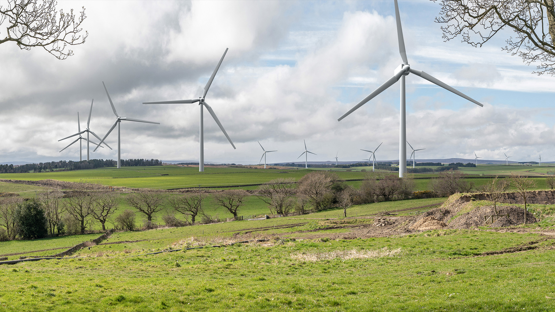
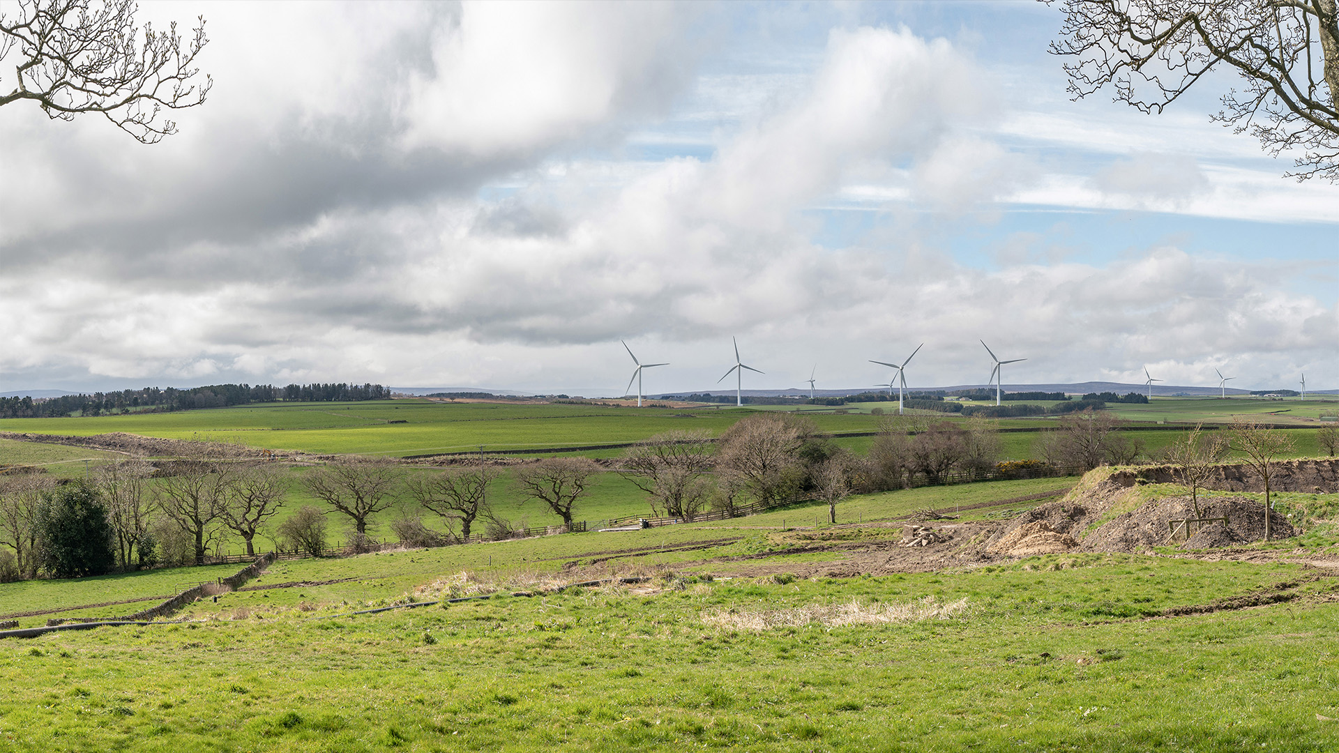
Our wind farm photomontages have been tested at the highest level and we have successfully applied these accuracy standards in a proportionate manner to other types of development such as energy from waste, minerals and solar sites, both in the U.K. and Ireland. This expertise and professional rigour has also led to peer review commissions and analysis of third party visualisations work.
Our 2D CAD drawing services offer precise, high-quality architectural, landscape and engineering designs tailored to the specific needs of your project. Whether you’re in the early stages of planning or refining detailed layouts, our team delivers accurate floor plans, site layouts, volumetric calculations, groundworks designs and technical drawings that meet regulatory standards. With expertise across a wide range of sectors, including residential, commercial and industrial developments, we ensure seamless integration of your vision into clear, compliant designs.
By leveraging advanced CAD, BIM and GIS technology, we provide scalable and editable drawings and models that enhance communication between stakeholders, consultants, contractors, and planning authorities. Our fast turnaround and attention to detail allow developers to visualise and quantify project components, identify potential design issues early, and streamline the design and approval process.
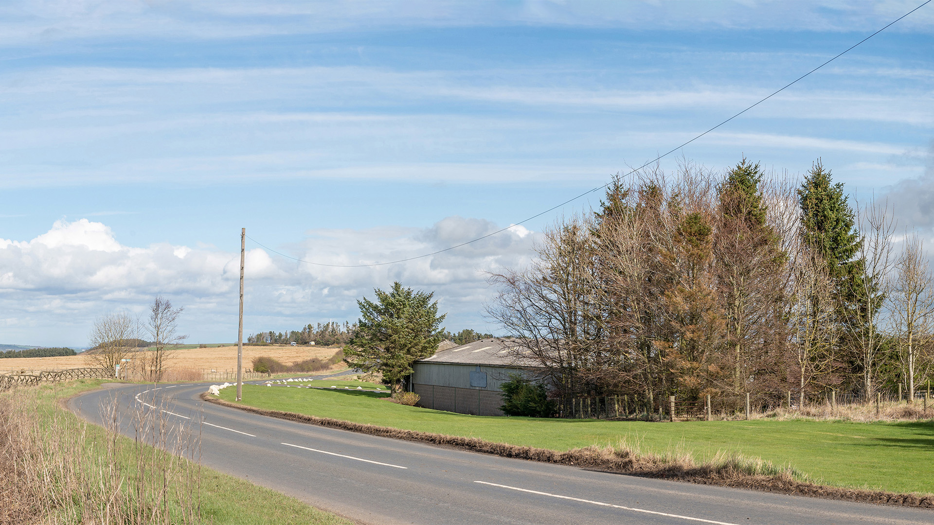
Arthian’s photomontage services provide developers with photorealistic visualisations that accurately depict proposed developments within their real-world environments. Using advanced 3D modelling and photography techniques, we create precise photomontages and visual representations that are fit-for-purpose for planning applications, public consultations and promotion of your developments. Our visual representations range from simple wireline visuals, to 3D massing images through to verified photo-realistic photomontages, all helping developers, planners and stakeholders visualise how a project will look and successfully integrate into its surroundings.
Verified montages are particularly valuable for use in Environmental Impact Assessments, where projects may be proposed in sensitive or complex environments and where visual or landscape effects may be difficult to ascertain; schemes such as wind farms, tall and large buildings and large-scale infrastructure projects. Our detailed, accurate imagery and rendering helps to communicate your proposals to stakeholders, reducing the risk of objections and delays, and giving certainty to understanding the visual and landscape, townscape, nightscape or seascape effects. With our expertise, clients can confidently present their projects with clarity and precision, supporting smoother decision-making and faster approvals.

Our fly-through and walk-through animation services offer dynamic, immersive visualisations that bring projects to life. By simulating a real-time journey through your proposed development, we help stakeholders experience the full scope and scale of your design before building has begun. Whether for urban planning, residential complexes, or commercial spaces, our high-quality animated visualisations showcase every detail of the project, from architectural features to landscaping, allowing you to present a compelling vision that resonates with investors, planning authorities, and potential buyers.
These animations are a powerful tool for communicating complex design ideas in a clear and engaging way and can capture 4D elements of a proposal, showing how a scheme will be built as well as used. Fly-throughs and walk- throughs can be used to highlight the benefits of projects, anticipate spatial challenges, and gain valuable feedback during the planning stages. With our expertise in creating visually stunning and technically accurate fly-throughs, you can enhance your presentations, streamline approvals, and build confidence in the success of your development.
Architectural visualisation is the process of creating visual representations, such as images, animations, or interactive models, to communicate and depict architectural designs and concepts. It helps architects, designers, and clients visualise and understand how a building or structure will look and function before it is constructed.
Visualisation diagrams are versatile tools in architecture, aiding in the design process, communication with stakeholders, compliance with regulations and the overall success of architectural projects. They play a crucial role in helping architects bring their ideas to life and ensure that designs are well-conceived, functional and aesthetically pleasing.
Photomontage in architecture refers to the process of creating a composite image by combining a photograph of an existing site or environment with a rendering or visualisation of a proposed architectural design. It is used to visually represent how a new building or structure will appear within its real-world context.
Creating effective montages in architecture necessitates accurate site photography, a detailed 3D visualisation of the proposed design, alignment of perspectives between the photo and 3D model, realistic lighting that matches the scene, and maintaining proper scale and proportion relationships. These elements ensure that the montage accurately conveys how the new architecture fits into its real-world context, helping architects, designers and stakeholders assess its impact and visual integration with the existing environment.
CAD is used for precise technical drawings and 3D models, primarily in engineering and architecture. Graphic design focuses on creating visually appealing graphics and layouts for marketing and communication. CAD emphasises precision, while graphic design emphasises aesthetics. CAD tools include AutoCAD, SolidWorks, and others.

I have been a graphic designer for over 25 years and have been specialising in photomontage, GIS and visibility mapping since 2004. I love using maps, 3D, visualisations and animation to tell the story of a project or process.
Senior Visualisation and Graphics Specialist

I am a 3D Technician & Photographer who has over 10 years experience in producing realistic renders and visualisations of proposed architectural designs in both commercial and residential.
3D Technician & Photographer

Director, Landscape & Heritage
CMLI CEnv FIAgrM PIEMA

